System Status

go! All services are operating normally

the Lake Line

Line status

go!
The Lake Line is operating normally.

About the Lake Line

An iconic image of this subway line.

Autumn at Long Pond.

Along its 67-mile subterranean course, the Lake Line traverses the full range of coastal Washington County's diverse topographies, habitats, cultures, and economies. It begins several miles offshore, in lobstering country, at Petit Manan lighthouse (the DRT's southernmost station), then follows the Petit Manan peninsula northward toward the historic shipbuilding hub of Milbridge. From there it leaves the coast behind and descends beneath the vast blueberry farms of Cherryfield and Columbia, under the former site of a proposed LIGO gravitational wave detector, and on into the deep woods (moose country!) of Northfield and Meddybemps, eventually reaching the bustling international border-crossing town of Calais. And all along the way, high above the DRT tunnels, the surface landscape sparkles with hundreds of crystal-clear lakes and ponds that were scratched and carved deep into the granite bedrock during the last glaciation.

The next time you hop on the Lake Line, be sure to bring along your passport. From Calais station, it's just a short walk along the Ferry Point Bridge across the St. Croix River into New Brunswick's delightful Saint Stephen. And if it's August, you just might want to stay on a bit longer for the annual week-long Chocolate Fest!

Petit Manan Google Maps

click image
to view photo gallery

Petit Manan station is the country's only underground subway stop that lies immediately adjacent to the boundary of a National Wildlife Refuge. Among the many ocean birds you will see at this important nesting habitat are puffins, razorbills, eiders, Arctic terns, great cormorants, and even the occasional oystercatcher. All summer long their chattering and scolding fills the air with an exhilarating din of pure, living sound. From time to time a pod of seals or a harbor porpoise will swim right past the station entrance. The waters out here can be tricky, with heavy ocean swell and powerful tidal currents, so leave your kayak at home and enjoy the sights and sounds safely from the comfort of the station's observation deck. (Note: the observation deck usually closes during unfavorable weather or sea conditions, per the stationmaster's discretion. Check the website before your trip: if the Water Line is open, the observation deck will probably be open, too!)

Station entrance: About 250 meters ESE of the Petit Manan lightouse.

Stationmaster: Jacquie Smith

Transfer here to: Moosehorn Line Lighthouse Line Water Line

 
Pigeon Hill Google Maps

click image
to view photo gallery

The Downeast Coastal Conservancy manages the land and trails of the Pigeon Hill Preserve, directly across the road from the station. From the trailhead, it's a short easy/moderate hike to the 317' summit, with sweeping views of miles of the Downeast coastline. Pigeon Hill Station is also the home of Earthsound Radio, 92.5 FM, which broadcasts

Station entrance: Just south of the Pigeon Hill Cemetery.

Stationmaster: JT Bullitt

Transfer here to: Peninsula Line

 
McClellan Park Google Maps

click image
to view photo gallery

Like nearby Pigeon Hill, McClellan Park is one of this area's hidden gems of spectacular natural beauty. Its rugged granite cliffs tumble down to meet the pounding surf at the mouth of Milbridge's Narraguagus Bay. It is a perfect spot for picnics, tidepooling, or painting — or just sitting quietly and gazing out into the endless expanse of the North Atlantic.

Station entrance: On Tom Leighton Point Road, at the corner of Watchtide Landing. From here it's about a 15 minute walk to the park entrance.

Stationmasters: Barrie Latzko and Kipp Latzko

Transfer here to: Peninsula Line Water Line

 
Milbridge-Bayside Google Maps

click image
to view photo gallery

Milbridge-Bayside station is located in the heart of the Milbridge theater district, directly beneath the Milbridge House restaurant. Within a short two-minute walk of the station entrance you can sample fine local cuisine from several notable restaurants, replenish your groceries and other supplies, visit the town library and post office, the regional field office of the Maine Coastal Islands National Wildlife Refuge, and much, much more. Hablamos español en Milbridge!

Stationmaster: Kristen Nabarette & the Milbridge House restaurant

Transfer here to: Water Line

 
Mano en Mano

This autonomous station offers limited services.
Tickets are available for purchase onboard the train.

 
Cherryfield Google Maps

click image
to view photo gallery

Cherryfield station is conveniently located on the Willey District Road, a pleasant 10 minute walk from the Down East Sunrise Trail. Bring along with you on the DRT your mountain bike, cross-country skis, or well-behaved horse and spend a day exploring the 85 miles of trail on this repurposed rail corridor.

Station entrance: Near #570 Willey District Road, Cherryfield.

Stationmaster: Curtis LaFollette

Transfer here to: Spruce Line

 
LIGO Google Maps

click image
to view photo gallery

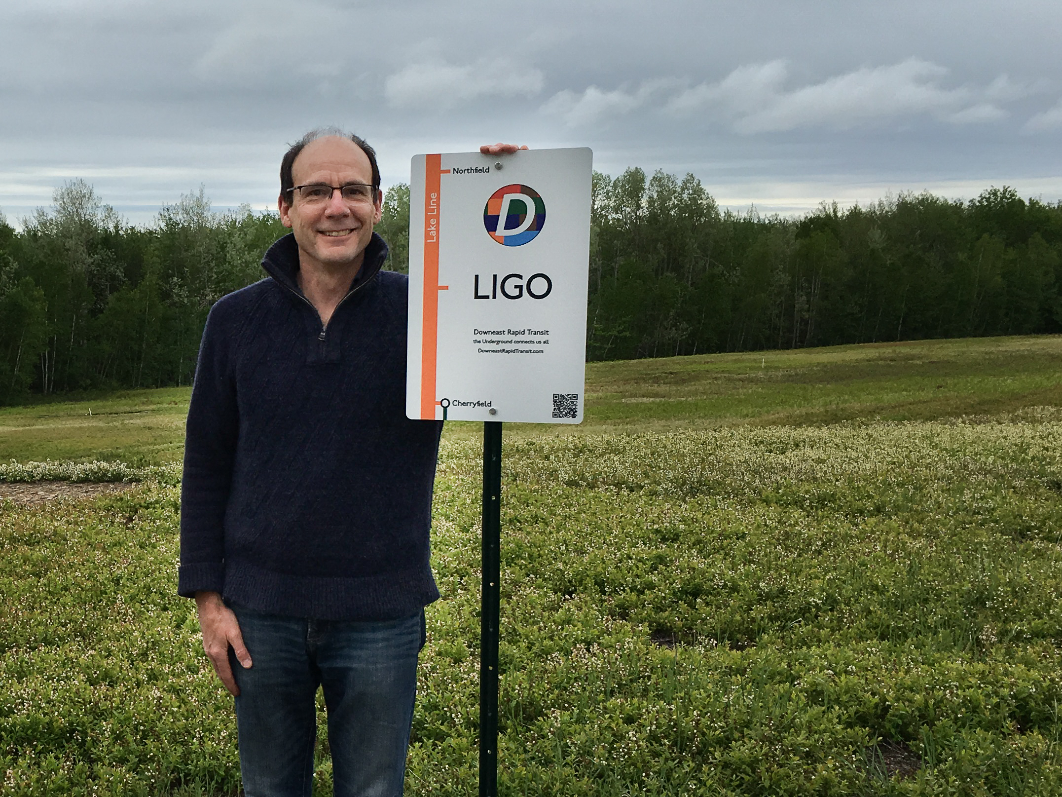
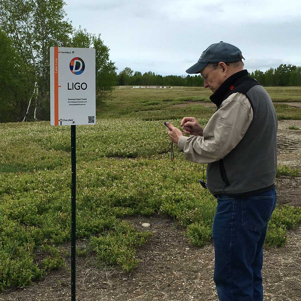
LIGO Station honors Downeast Maine's fleeting connection with one of the grandest achievements of modern science. In the 1980's the Laser Interferometer Gravitational-Wave Observatory (LIGO) Project identified this spot in Columbia near Schoodic Lake as a candidate site for their eastern U.S. gravitational wave detector.

The story begins in 1915, when Albert Einstein published his General Theory of Relativity, sparking a revolution in scientific thought that transformed our understanding of the Universe. Despite the theory's many successes, one of its strange predictions could not be immediately confirmed: that massive bodies in motion can send tiny ripples in the fabric of spacetime hurtling outward into the Universe at the speed of light. Because these "gravitational waves" were such a subtle effect, physicists initially doubted that they could ever be observed. But, thanks to the dogged efforts of a few hardy researchers and advancements in technology that Einstein could never have foreseen, these spectacularly tiny vibrations have now been recorded.

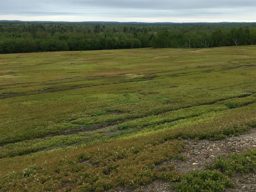
But where do you begin to look for these spectacularly tiny vibrations? The designers of LIGO knew that a gravitational wave detector called for a special site. It would have to be an exceptionally quiet place, far from sources of man-made and seismic noise. It would have to be on relatively flat and dry terrain, with plenty of wide open space on which to erect the detector's L-shaped pair of perfectly straight 4-kilometer-long laser interferometer tubes. Once built, the detector would require access to high-voltage power lines to drive the sophisticated lasers, electronics, cooling systems, and computers. The blueberry barrens near Schoodic Lake met all these criteria and seemed an eminently suitable fit. [See the 1985 introductory letter from the LIGO team to U.S. Representative Olympia Snowe.]

As part of the site evaluation process, the Archaeology Research Center of the University of Maine at Farmington conducted a field survey in 1987 to assess the impact of LIGO construction on archaeologically sensitive sites in the area. Although the survey did find traces of significant ancient human activity nearby — some dating back to the early Holocene era (9,000-7,000 BCE) — the researchers concluded that LIGO construction would pose no threat to these sites. ["Archaeological Phase I Survey and Phase II testing of the Laser Interferometer Gravity-Wave Observatory (LIGO) Project in Columbia Twp, Washington Co. ME", Petersen and Heckenberger (1987); Maine Historic Preservation Commission document #2454]

Despite these promising indications, the National Science Foundation eventually selected an alternate site in Livingston, Louisiana for LIGO's eastern detector. (A site in Hanford, Washington was chosen for the western detector.) The project went forward, the detectors were built, and in 2016 LIGO announced that both had successfully recorded the first-ever gravitational waves, apparently generated from a distant pair of colliding black holes. With this dramatic discovery the last untested prediction of Einstein's General Theory of Relativity was confirmed and a door opened to an entirely new kind of deep-space astronomy.

Although the LIGO detector in Columbia was never built, this tranquil spot in the rolling blueberry barrens of rural Maine stands as an important landmark to the ingenuity of the human intellect, and a reminder of Maine's long history as a place for creators, thinkers, visionaries, and dreamers.

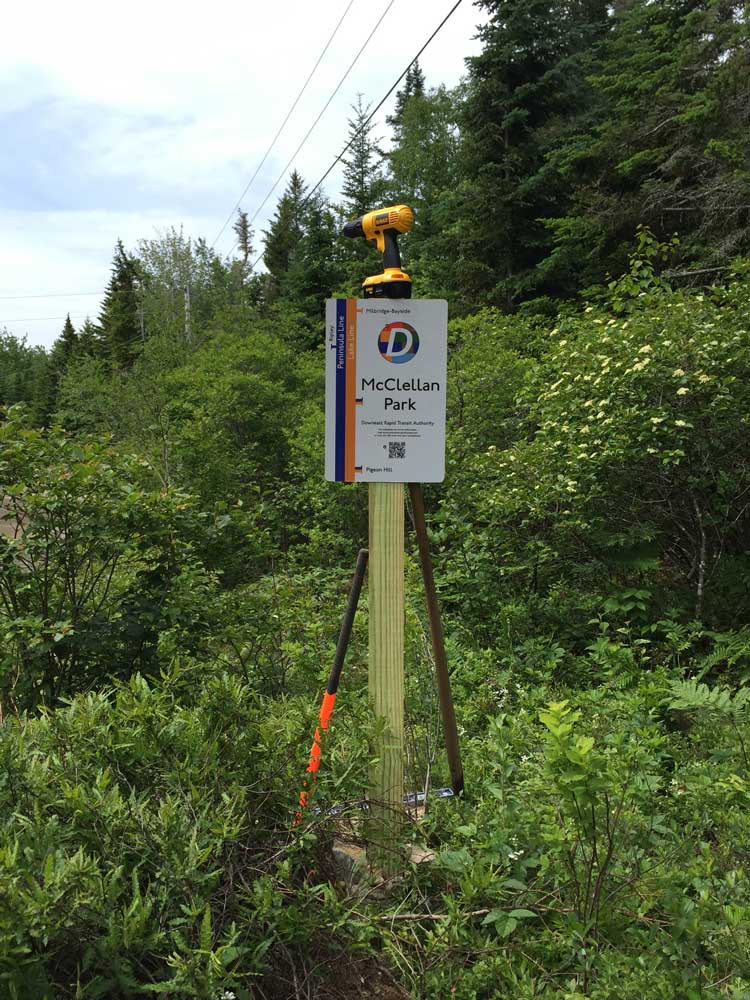
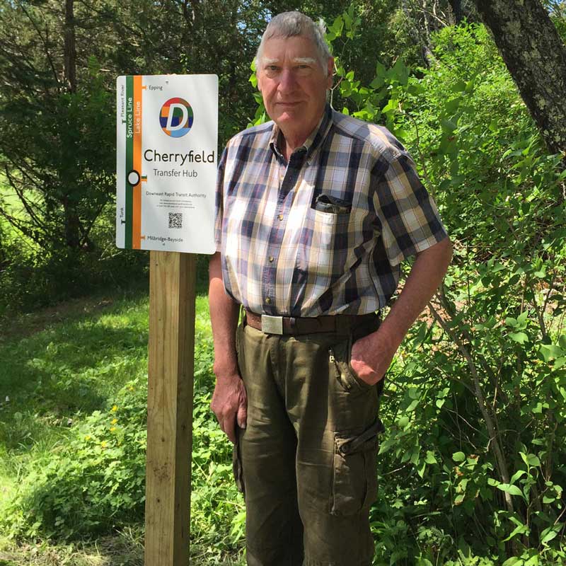
Station entrance: Off Webb District Road (near Baseline Rd.), Columbia. Near the Epping Baseline West survey marker, and stop #21 on the Maine Ice Age Trail.
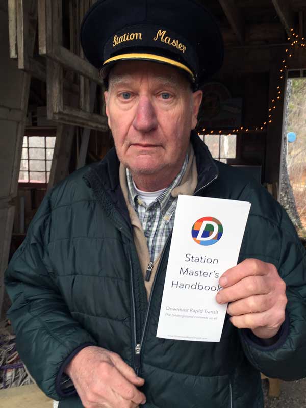
Stationmasters: Rainer Weiss and Peter R. Saulson

 
Northfield

This autonomous station offers limited services.
Tickets are available for purchase onboard the train.

Transfer here to: Barrens Line

 
Meddybemps

This autonomous station offers limited services.
Tickets are available for purchase onboard the train.

Transfer here to: Barrens Line Moosehorn Line

 
RSS